
Wareham ZIP Code Coverage
USPS location pages verify four Wareham-labeled postal facilities. Their labels help orient a search, but a ZIP polygon can cross municipal lines and one village label does not create a separate town. The most dependable ZIP code directory method is to pair the label below with USPS address lookup before using it in a parcel or records search.
| ZIP | Areas covered | Post office | Postal note |
|---|---|---|---|
| 02538 | East Wareham and eastern Wareham, including the White Island Shores area commonly using the label | East Wareham Post Office | Standard delivery label; boundary is not town-line proof |
| 02558 | Onset | Onset Post Office | Verify each street address with USPS; the label is often treated as PO-box or Onset coverage |
| 02571 | Wareham and Wareham Center | Wareham Post Office | Standard delivery ZIP; a Wareham Annex is also listed |
| 02576 | West Wareham | West Wareham Post Office | Standard delivery label; it does not change town government |
| 02532 | Buzzards Bay | Buzzards Bay facility in Bourne | Do not treat it as routine Wareham coverage without an exact USPS result |
Wareham Center, Onset, East Wareham, West Wareham, Great Neck, the Narrows, Tihonet, and other local names sit inside one incorporated town. Postal city, assessor city, situs town, and a deed’s legal description can therefore use different words for a related place.
Verify a Wareham ZIP Code
Use the USPS address-to-ZIP lookup for a complete street address, city, and state. Do not derive a ZIP from a map centroid, nearby post office, or a person’s mailing label. USPS resolves the delivery address, while property and public records use their own fields and boundaries.
The USPS ZIP lookup is the best final check before recording a Wareham ZIP code. Enter a complete address rather than assuming that every street in a village uses the same label.
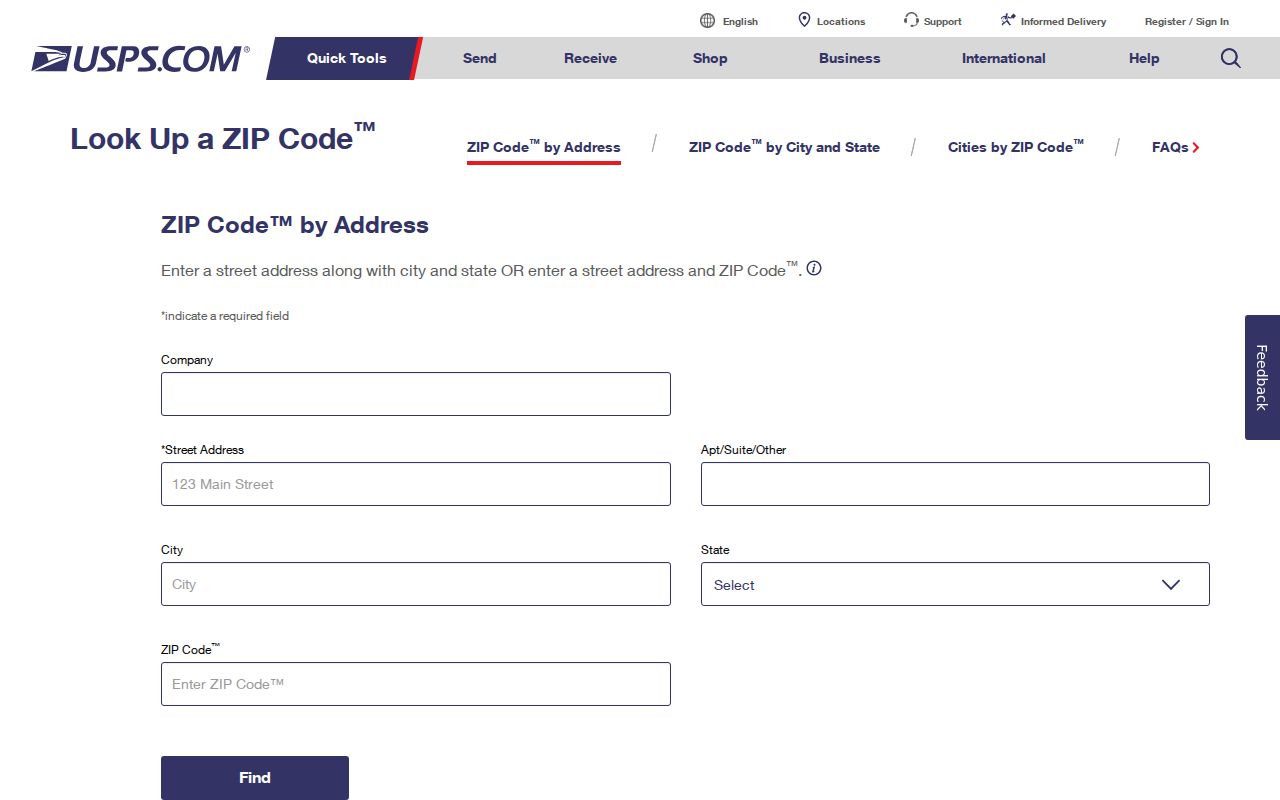
The USPS result answers a delivery question. It does not show the owner of record, all residents, municipal precinct, or a parcel’s legal description.
- Enter the complete address in the USPS form and save the returned postal city and ZIP.
- Search the same address in MassGIS or the Wareham assessor to identify the parcel.
- Use the parcel’s situs address and map or PID for a property question.
- Request municipal voter records from the Town Clerk when a lawful local record is needed.
- Use town, party, date, and document filters rather than ZIP in the Registry deed index.
02538 East Wareham ZIP Code
02538 is the East Wareham postal label. Research identifies it with eastern Wareham and the White Island Shores area commonly using that label. The East Wareham Post Office is at 2991C Cranberry Highway. The physical facility confirms the postal label; it does not define a municipal or assessment boundary.
The USPS location page for East Wareham 02538 is shown below. Confirm a specific delivery street through the ZIP lookup rather than treating the office address as a coverage map.
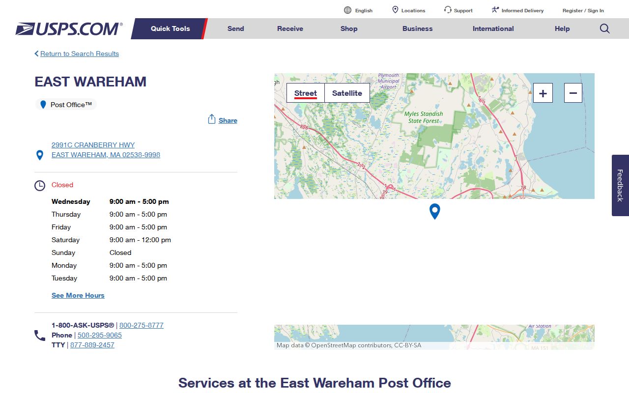
For an address close to another village label, preserve both the USPS result and the assessor’s situs town when comparing records.
02558 Onset ZIP Code
02558 is the Onset postal label, served by the Onset Post Office at 214 Onset Avenue. It is often described in ZIP listings as an Onset or PO-box label. The research does not establish that every Onset street receives 02558, so address-by-address USPS confirmation is essential.
This USPS Onset location view ties 02558 to a real local facility. It is not evidence that a mailing address marks a separate incorporated municipality.
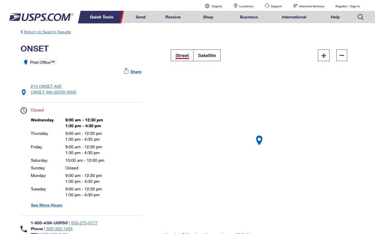
Onset’s older resort and cottage history can also produce changing village descriptions in historical records. Use the returned ZIP, street, and date together when reconciling an old entry.
02571 Wareham ZIP Code
02571 is the central Wareham and Wareham Center postal label. The Wareham Post Office is at 248 Main Street, and its USPS page also lists the Wareham Annex at 25 Tobey Road. This is a standard delivery ZIP, but it still should be confirmed for a given address before it is put into a records request.
The Wareham 02571 USPS location page provides the facility detail shown here. Use it for postal logistics, then use town or parcel records for residency and ownership questions.
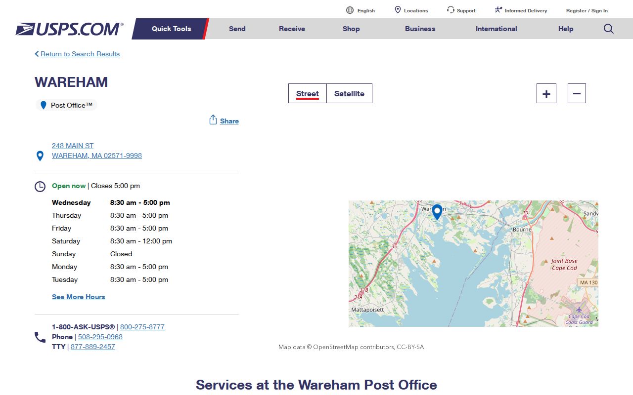
A Wareham label on mail may be useful for address matching, but a deed’s town field and a map-lot identifier are stronger anchors for land records.
02576 West Wareham ZIP Code
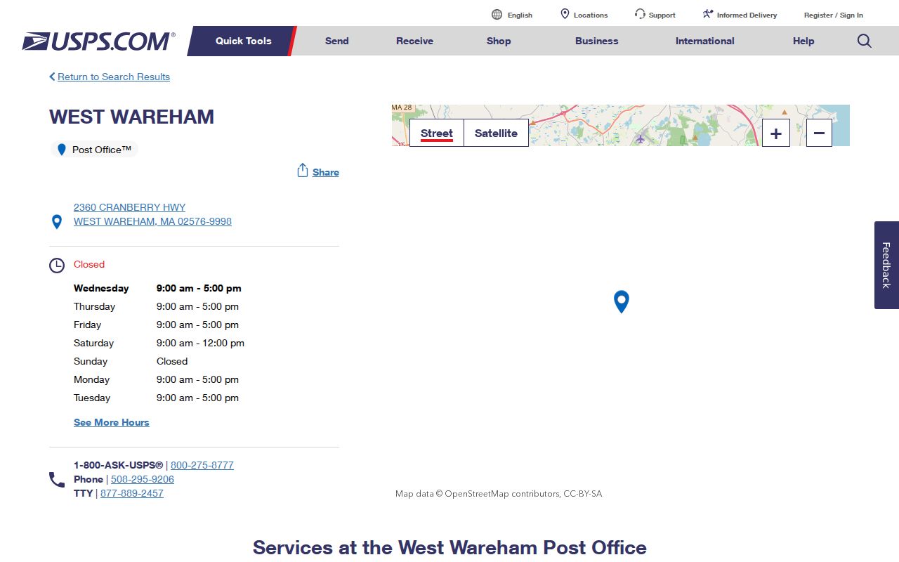
02576 is the West Wareham label. Its verified postal facility is the West Wareham Post Office at 2360 Cranberry Highway. West Wareham was historically part of Rochester before Wareham’s 1739 incorporation, which helps explain why older geography can take more than one name. The postal label does not change the present town custodian for municipal records.
The USPS West Wareham 02576 page confirms the facility and label. Its location detail should be followed by a full-address check if a street lies near a perceived village or town edge.
Keep the historical West Wareham label as a search variant in old directories and deeds, then resolve the exact place through map, lot, and legal-description evidence.
Search Wareham by ZIP Code
MassGIS can use ZIP in its location search, but a ZIP search returns geography and parcels, not a household roll. The Wareham-specific MassMapper accepts a full address with town or ZIP, street plus town, a landmark, municipality or village, ZIP, or coordinates. Once a location is found, activate Property Tax Parcels, identify the parcel, and inspect the parcel table or map extent.
| Location search | Full address plus town or ZIP, street plus town, landmark, village, ZIP, or coordinates. |
|---|---|
| Property Tax Parcels | Layer that displays parcel polygons for a selected location. |
| Identify | Map tool that opens parcel attributes for a chosen polygon. |
| Parcel table | Selected or map-extent rows; export may be available. |
| Find Abutters | Shows adjacent parcels, not a ZIP-wide resident list. |
Vision may display site and owner ZIP fields, but its Wareham welcome screen does not document a ZIP-wide browsing mode. Town voter records are requested by municipality or precinct, not through a public statewide ZIP filter. TitleView deed searches use town, date, name, and document type rather than ZIP. When a ZIP has narrowed the place to a road, use the Wareham streets directory for the address sequence.
Wareham ZIP Code Boundaries
A ZIP boundary is a postal delivery boundary, not a Wareham town limit. A town address may use East Wareham, West Wareham, or Onset as its postal city, and a ZIP polygon can serve rural or adjacent-town delivery routes. The 02532 Buzzards Bay facility is in Bourne, so it must not be called a routine Wareham ZIP without USPS address confirmation.
- ZIP versus ZIP+4
- The five-digit ZIP identifies a postal area; the added four digits narrow delivery sorting for part of that area.
- PO-box ZIP
- A ZIP used for post office box delivery that may not match every nearby street’s delivery ZIP.
- Unique ZIP
- A ZIP assigned to one organization or destination, unlike the four verified Wareham-labeled facilities.
- Carrier route
- A postal delivery sequence within an area, not a legal town, parcel, or residency boundary.
Wareham ZIP Code Village Names
Postal labels sit on top of a much older local geography. Wareham is one incorporated town, yet its records may use Wareham Center, Onset, East Wareham, West Wareham, Great Neck, the Narrows, Tihonet, Weweantic, or Swift’s Beach. Eastern Wareham began as the Agawam Plantation area, West Wareham was part of Rochester before the 1739 incorporation, and Tihonet was annexed from Carver and Plymouth in the eighteenth century. Those names can be valid search variants without becoming present-day town lines.
For a historic address, search the village name alongside Wareham, then compare the road, nearby owner names, map-lot, and legal description. A map group or parcel ID can be more stable than a postal street name because the town assessment index has map groups 1 through 134 and submaps. No official source verified a town-wide street renumbering or renamed-street year, so do not force an old entry into a modern postal label without supporting parcel or deed evidence.
That local naming pattern is why a ZIP code directory should be used as a first sort, not a final identity. The postal answer, assessor situs, and Registry town field can all be useful at once, but they describe different systems.
Wareham ZIP Code Record Limits
A map or assessor ZIP field can show parcels whose situs ZIP matches a query. It cannot establish every person at those parcels. A municipal voter request has different geography and omits confidential registrations. A Registry search is county land-record metadata, not a ZIP roster. These limits matter most near village labels and municipal edges, where a postal result can look more precise than it is.
No official Wareham ZIP split or realignment year was located in the research. Do not create one from an old map or a directory abbreviation. For a current address, USPS is the verification source; for a historical address, compare the village label, map-lot, nearby owner names, and legal description.
Note: A ZIP code helps locate a delivery address, while municipal and county custodians determine which public-record route can answer the next question.