
Wareham Neighbors by Block Source
Different records answer different block questions. MassGIS begins with adjacent parcel geography. The Vision assessment card attaches an owner, parcel identifier, and sale bridge to a specific lot. A Registry deed can explain the lot's transfer history. Local voter material is a separate municipal record held by the Town Clerk, with important exclusions. The community layer is even narrower: public event and contact pages may help identify an organization, but they are not household rosters.
| Wareham source | What it can show around an address | Access and limits |
|---|---|---|
| MassGIS parcels and Find Abutters | Adjacent parcels, map geometry, and selected parcel attributes | Free web map; it is not a list of household members |
| Vision assessment database | Parcel owner, situs and mailing fields, value, and sale bridge | Free property card; verify any owner-search mode in the live interface |
| Plymouth Registry deed and plan | Transfers, legal descriptions, plans, and ownership chain | Free search and view; home printing has a TitleView subscription charge |
| Wareham municipal voter records | Publicly listed voter fields allowed by state law | Request through the Town Clerk; confidential and withheld fields stay out |
| Inspectional Services permits | Address-linked work history where public fields are available | ViewPoint and department route; applicant identity is not occupancy proof |
| Onset Bay Association | Public civic mission, events, and contact path | Association site; no membership roster was verified |
Use the table as a scope check before naming Wareham neighbors. A parcel record can document a relationship to land. It cannot tell who is inside a building at a particular moment, and the owner mailing address can be a trust, business, attorney, or address elsewhere.
Map Wareham Neighbors with Parcels
The Wareham MassGIS MuniMapper supports a full address with town or ZIP, a street plus town, a landmark, a village or neighborhood, a ZIP, or coordinates. Turn on Property Tax Parcels, select the matching location, and use the identify tool on the parcel. Then use Find Abutters to display adjacent parcels. If the control is unavailable in the Wareham view, browse the parcel polygons or use the map-extent parcel table instead. A buffer can be useful for orientation, but it is not a legal definition of a neighbor.
- Enter the full address, adding Wareham or its ZIP if the location search is ambiguous.
- Activate the Property Tax Parcels layer and click the parcel that matches the site address.
- Select Find Abutters, then inspect each adjacent parcel popup or the selected-parcel table.
- Write down the PID or map-lot, situs address, use code, owner field, and map relationship for only the parcels that actually touch the target.
- Open a Vision card or Registry deed for a particular parcel when a transfer or ownership detail needs confirmation.
The Massachusetts Interactive Property Map explains the address search, parcel popup, table, and Find Abutters feature. The screenshot shows that parcel-map workflow. It is a starting point for Wareham neighbors, not a substitute for the authoritative deed or a survey.
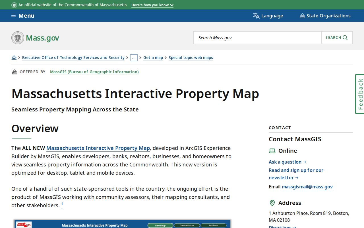
Read the selected rows with care. A parcel table can be filtered to selected or map-extent parcels and exported, but it still describes land records. Recheck the legal description and map boundaries before drawing conclusions about a shared boundary, right of way, or ownership history.
Read Wareham Neighbor Parcel Cards
For a selected parcel, the Wareham Vision assessment database supplies the current property layer. The general card pattern includes location, MBLU or parcel/PID, owner and co-owner, valuation year, owner mailing address, sale date and price, Registry book/page, building data, and map link when those fields appear on the Wareham result. The fiscal-year assessment is useful context, yet it is not a current-presence record and it should not be confused with market price.
- Situs address
- The physical location of a parcel, used by the assessor, GIS, permits, and emergency-addressing systems.
- Owner mailing address
- The address used for the tax bill. It may be elsewhere and does not establish that the owner occupies the parcel.
- PID or map-lot
- An assessor or map identifier that helps connect a parcel card, assessment map, and recorded deed.
- Legal description
- The lot, bounds, plan, or certificate language used in the recorded land system, often more stable than a street number.
Wareham has assessment maps numbered 1 through 134 with submaps. They are for assessment use and are not valid conveyance descriptions. Where an address is hard to find, the map-lot and the Registry deed provide a stronger bridge than a postal label alone.
Verify Wareham Neighbors Through Deeds
When a parcel card lists a book and page, move to Plymouth County TitleView for the underlying transfer. TitleView has recorded-land, registered-land, plan, and Plymouth Colony modes. For recorded land, compare the grantor, grantee, recording date, plan, legal description, and stated exceptions. For registered land, use the Land Court certificate route instead of treating a certificate number as a recorded-land book and page.
Deed search and image viewing are free. The Registry says its linked grantor and grantee record reaches August 6, 1686 to current, with scanned names back to 1685; its plan index reaches 1890 to current and Land Court material reaches 1899 to current. That depth makes a deed useful for historical parcel questions, though a deed should never be used to infer a current household from an old transfer.
Wareham Neighbors and Voter Records
Massachusetts provides a personal voter-status tool, but it is not a public statewide name-and-address directory. A request for a Wareham municipal voter list goes to the Town Clerk. State guidance identifies public local list fields as name, address, party or enrollment, date of birth, active or inactive status, and voter ID. Elections participated in, previous voter-record changes, mailing address, registration date, and inactivity date may be public on request. Phone, email, veteran status, permanent absentee status, confidential records, and protected minor or pre-registration material are excluded.
Send a narrow written request to the Wareham Town Clerk with the record sought, date range, preferred paper or electronic format, and delivery contact. The office is the municipal custodian. A public record request under M.G.L. c.66 §10 seeks existing records; it does not require the Town to create a new block directory or answer a research question. The statewide voter list is restricted and not public.
Registration is not presence. A voter record relates to registration, not a guarantee that someone is currently at an address, and it never discloses a person's ballot choices.
Wareham Neighbors in Civic Life
Community contacts are useful when the goal is to learn about a village or public event, not to build a list of residents. The Onset Bay Association, founded in 1992 and organized as a 501(c)(3), promotes civic pride, beautification, shared-space care, and events in historic Onset Village. Its public page provides a civic and event contact route. It does not verify a member roster, so association involvement should never be treated as proof that someone lives at a particular address.
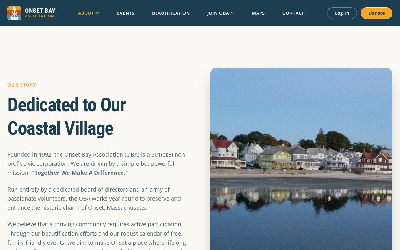
The association page helps distinguish the public community layer from property records. For Onset research, pair its civic information with the parcel map and village-label searches. A historic resort area can have seasonal address clues, while a public association page still remains a contact source rather than a household index.
Onset Bay Association
Historic Onset Village civic, beautification, shared-space, and event contact route. Founded in 1992. No public member list verified.
Wareham Fire District
Separate local government with public meeting, warrant, and election records. Those records do not form a household directory.
Onset Fire District
Separate local government within town boundaries, with its own water and fire governance records rather than a resident roster.
Two Districts, One Wareham Block
Wareham is one town, but blocks can be described through overlapping local geography. Onset, East Wareham, West Wareham, Wareham Center, Great Neck, the Narrows, Tihonet, and Swift's Beach are all meaningful search labels. Wareham and Onset also have separate fire districts, each with its own water and fire governance and district elections. Public agendas, warrants, and meeting records may reveal civic decisions for a district, but neither district publishes a household directory.
Older records use geography that can be more complicated. Eastern Wareham grew from Agawam Plantation. West Wareham was once part of Rochester, and Tihonet was annexed from Carver and Plymouth. When a block does not appear under the label expected today, try the village name, nearby owner, map-lot, or deed plan reference before assuming the record concerns another town.
Official Sources for Wareham Neighbors
Official records have a known custodian and a defined scope. MassGIS describes parcel relationships. Vision presents assessment information. The Registry preserves land instruments. The Town Clerk handles the local voter-record route. A commercial neighbor-search category may combine material from several sources, but its update cycle, matching method, and underlying access rules can be unclear. It is not a replacement for checking the actual parcel, deed, or Town Clerk record.
| Official parcel and deed route | Shows the source record, its custodian, and the limits of what it documents. |
|---|---|
| Commercial neighbor-search category | May combine records, but results need independent confirmation against the official source. |
| Community organization page | Supports public event or contact research, not an inference about every person in a neighborhood. |
For an entire named street rather than a small set of adjacent parcels, use the separate Wareham streets directory workflow. It follows address-keyed records along the street and avoids turning a block map into a broader people list.
Privacy Limits for Wareham Neighbors
Several sources intentionally leave information out. Parcel rolls do not identify every person in a building. Utilities and motor-vehicle addresses are not ordinary public household sources; the Driver Privacy Protection Act, 18 U.S.C. §§2721–2725, restricts personal information from motor-vehicle records. Public local voter material excludes confidential voters and other protected fields. The Massachusetts Address Confidentiality Program, M.G.L. c.9A and 950 CMR 130.00, provides a substitute address for qualified participants, and confidential voter registration is governed by M.G.L. c.51 §§37, 41, 51A and 950 CMR 49.00.
Use a block search lawfully. Parcel and civic research can support neighborhood awareness or local history. Do not use it to watch, threaten, harass, or intimidate a person, and do not try to identify anyone omitted from a public record.